
No products in the cart.
Outdoor Adventure
10 Best Short Thru-Hikes in the U.S.
08
Jul
Jul
By the time you’re 100 miles into a thru-hike, no matter how far you ultimately plan to go, you’re likely hitting your stride. Your legs loosen from their first few days of pain. You grow accustomed to eating freeze-dried food from a bag and filtering water from rivers or lakes. Your body adjusts to the rhythm of the day—to rising before the sun and setting with it, too. This first on-foot century is crucial for establishing a system that will last you for months, keeping you in motion on any lengthy trail.
That said, most folks just aren’t able to commit the time it takes to tackle a thru-hike, as much as they might like to. Kids, jobs, mortgages: So many factors pull people back home after a shorter backpacking stint on some long trail. Even as a career freelancer with no kids or mortgage, who has rearranged my entire life to allow for long-distance hikes, I find the timing and logistics are still daunting to pull off.
The good news? You don’t need to walk thousands of miles to understand the challenges and joys of a thru-hike. Here I’ve selected 10 backpacking treks in the U.S.—most under 100 miles, except two very special, just slightly longer ones—that will get you into a groove and give you a taste of prolonged life on the trail.
Greenstone Ridge Trail, Michigan
???? Length: 42 Miles
???? Duration: 2 – 6 Days
⛰️ Elevation Profile: Gentle, with less than 5,000 feet of total gain
???? Best Starting Point: Windigo Visitor Center
???? Why We Love It: Near-complete solitude in an archipelago on the eastern edge of the largest Great Lake, where wolves and moose abound? Hard to argue with the magic of that.
Transportation is an inevitable complication in beginning or ending any thru-hike. How do you get to or from a remote trailhead or terminus, whether it’s deep in the Florida Everglades or high in the Maine wilds? I’ve had friends drive eight hours just to pick me up and immediately return to civilization. Though located on the Minnesota flank of Lake Superior and very near the Canadian border, Isle Royale is Michigan’s only national park. And though it’s less than 200 miles from Duluth and 50 from Thunder Bay, getting there and back to the mainland is a whole ordeal, requiring ferries or seaplanes or some combination of both.
But we pursue distant trails for the solitude, and Isle Royale—typically the least-visited national park in the Lower 48—entirely delivers. The Greenstone Ridge Trail follows the high central ridge to traverse the length of the island, running through forests of maple and birch, fir and aspen. With nine non-crowded campgrounds along the route, and no advance permits required, you can set your own pace. My feeling is that you will want to stick around this zone, though there are lots of offshoot trails leading deeper into the island on either side of Greenstone’s spine if you crave some overnight out-and-backs. Wherever you go, keep your eyes peeled for moose and gray wolves, both of which have lived here since 1948 as predator and prey. Truly, the Isle is a quiet paradise well worth the hassle of reaching its shores.
Don’t Miss: As the story has it, Suzy Tooker, the daughter of a fisherman, used to canoe to Isle Royale from nearby Tooker Island long before it became a national park. On these journeys, she either played or sought shelter in what is now called Suzy’s Cave—a low-slung, arched alcove formed by the high waves of Lake Superior 4,000 years ago.
Batona Trail, New Jersey
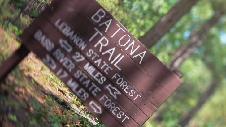
???? Length: 53.5 Miles
???? Duration: 2 – 5 Days
⛰️ Elevation Profile: Extremely gentle, with a few hundred feet of total gain
???? Best Starting Point: Bass River State Forest
???? Why We Love It: “I was in the pines,” John McPhee wrote in his canonical 1968 book, The Pine Barrens, “because I found it hard to believe that so much unbroken forest could still exist so near the big Eastern cities, and I wanted to see it while it was still there.” We completely agree.
A chief challenge of long-distance hiking, especially on the relatively flat East Coast, is to find beauty in subtle landscapes—to be charmed by the so-called green tunnel of the Appalachian Trail where forest views outnumber those of striking vistas. This certainly applies to the Batona Trail, which gets its name from a contraction of “Back-to-Nature” and cuts through the fabled and wild Pine Barrens of southern New Jersey. Named long ago for their lack of agricultural fecundity, the Barrens actually support an abundance of wildflowers and birds, black bears and bobcats—plus, of course, a seemingly endless expanse of pine trees. For the hiker, such a setting presents a challenge: Revel in the place and its repetitive vibe of pines and sand and tannic ponds or get very bored. I find the Barrens, or Pinelands if you prefer, completely mesmerizing, an ocean of towering trees.
Keep the context of the place in mind, too, as you stroll through retired cranberry bogs and trails softened with the duff of pine needles: In the late ’60s, the Barrens were supposed to become the site of a new city and what might have been the world’s biggest airport at the time. But conservation efforts took off, and a decade later, the place became the first national reserve in the U.S. As you follow pink blazes splashed across pine bark, remember: Over 50 years later, this place endures as a natural win on the crowded East Coast.
Don’t Miss: As the cheeky name of the Batona implies, one reason we hike is to get closer to our essence, back to the woods from which we came. In the 18th century, that would have been an alien idea for the people of southern New Jersey, establishing settlements as a way to shelter from the cold. One of those, Batsto Village, still exists as a living history installation, with ironworks and ice houses, should you need a reminder of modern convenience.
Knobstone Trail, Indiana
???? Length: 58 Miles
???? Duration: 3 – 5 Days
⛰️ Elevation Profile: Difficult, with some measurements clocking 10,000 feet of gain
???? Best Starting Point: Delaney Creek Park
???? Why We Love It: Why wouldn’t you want to see the puzzled look on someone’s face when you tell them that a short trail in Indiana kicked your ass?
A true joy of thru-hiking is its ever-renewing sense of surprise. No matter how much you’ve studied your maps or how many vlogs you’ve consumed, there’s no way to imagine how the trail will actually feel to you, how you will experience the miles as they unfold. And sometimes, these surprises land a little like body blows—did you know that Virginia was that hilly, or New Mexico had that many river crossings? And so it will likely go for you on the Knobstone Trail, a secretly strenuous stretch of southern Indiana where obstinate siltstone, sandstone, and shale have created a chain of thin ridges and steep hills that sometimes rise several hundred feet over the flatlands below. It’s not just the white blazes on trees that have earned the Knobstone the infamous epithet “The Little Appalachian Trail”; it’s the constant sense of up and down.
Cutting through several state forests and recreation areas, the Knobstone was created in the ’70s from badly eroded farmland that had been salvaged by the state. It roughly follows the Knobstone Escarpment, a richly forested expanse of “knobs” and ravines that steadily slide into the Ohio River at the Kentucky border. As you move south, the climbs get bigger and harder; as the Knobstone Hiking Trail Association notes, the path is often strenuous because it has to bypass private land. The trail continues north in three more sections, but how much more do your Hoosiered-out legs want?
Don’t Miss: There are a few choices for the northern terminus of the Knobstone, but, given the rollercoaster of terrain that will soon follow, it’s hard to resist the pull of starting with a day at Delaney Creek Park. Rent a primitive cabin (from $60 per night), swim in its long lake, and grill up something hearty before hitting the trail early the next day. Later, when you finish in the south, you’ll find that Louisville—just across the state line, in Kentucky—is a little city of grand indulgence. Think: home to the Kentucky Derby, stellar bourbon, and stunning Ohio Riverfront.
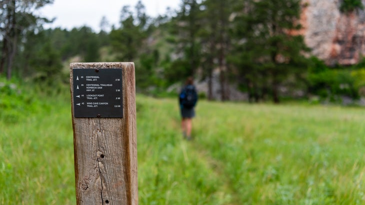
Centennial Trail, South Dakota
???? Length: 125 Miles
???? Duration: 4 – 8 Days
⛰️ Elevation Profile: Moderate but steady, with more than 20,000 feet of gain
???? Best Starting Point: Bear Butte State Park
???? Why We Love It: Skip the buzz of Mount Rushmore, knowing there is no area more beautiful, open, and less crowded in the country than the Black Hills.
Long trails do not exist in a vacuum. On the Pacific Crest Trail, for instance, you might contemplate the labor struggles of Cesar Chavez near his home around Tehachapi or American separatism in NorCal’s so-called State of Jefferson. On the Appalachian Trail, you will walk through remnants of multiple wars. Few places in the U.S. are more fraught with unresolved tension than South Dakota’s Black Hills, land stolen from the Sioux after treaties had been signed in order for avaricious Americans to pursue gold. The faces of four presidents are carved into one mountain, that of a Lakota leader into a neighboring one. Custer is one of the region’s hubs named after the controversial Civil War general, and we all know how his story ended.
There’s plenty of space and time to ponder all of this on the Centennial Trail, an isolated and wildly underrated track between this exquisite region’s bottom and top, populated by massive stands of Ponderosa pines, herds of bison, towns of prairie dogs, and the very occasional mountain lion or rattlesnake. Start at Bear Butte, a striking volcanic remnant sacred to multiple Plains Nations, and end at Wind Cave, the underground opening from which, legend holds, the Lakota emerged long before it became Wind Cave National Park. The Black Hills are as majestic as they are complicated, and the Centennial Trail, or Trail #89—nicknamed for the year South Dakota became a state—is a perfect showcase.
Don’t Miss: There is a spur trail to Mount Rushmore, but trust me: That memorial to colonialism and imperfect men is more exciting in National Treasure: Book of Secrets than in person. Instead, detour to climb Black Elk Peak, a marvelous little mountain that happens to be the highest point between the Rockies and the Pyrenees. And when you finish the hike, go soak at nearby Moccasin Springs ($29 for three hours) and eat at Buffalo Dreamer.
North-South Trail, Rhode Island, Connecticut, and Massachusetts
???? Length: 78 Miles
???? Duration: 3 – 4 Days
⛰️ Elevation Profile: Gentle, with less than 5,000 feet of total gain
???? Best Starting Point: Douglas State Forest
???? Why We Love It: What’s not to relish about ending a rather flat hike through one of the nation’s smallest, least-known, and oldest states by jumping into the ocean?
On a thru-hike, there are few feelings of achievement better than crossing a state line. Not only have you reached another benchmark on your journey, but you’ve propelled yourself across a state by foot, only to do it again. With a terminus in Massachusetts and a brief interlude through Connecticut hemlocks, Rhode Island’s North-South Trail supplies that sensation three times and lets you traverse an entire state, even if it’s the smallest one. Plus, you’ll learn about the bugaboo of all thru-hikers, the oft-dreaded road walk and the foot pains it can bring, and hear the roar of nearby interstate traffic. Bugs can be thick come summer, and camping can be hard to come by if you need more than three days.
But on this generally level route along short ridges, you’ll also wind through the vestiges of old U.S. settlements, drift around the gentle shores of Rhode Island’s many inland ponds, and spy a historic toll house 20 miles from the state capital, Providence. Oh, and I mentioned the beach, right? When you begin the southward walk on this blue-blazed trail, you’ll spot a sign that says you’re 78 miles from the ocean, at beautiful Charlestown Beach. Is there a better motivation to hike on?
Don’t Miss: Known for 400 miles of coastline, Rhode Island probably isn’t the first state that comes to mind when you consider glaciers. But Arcadia Management Area, during the trek’s southernmost third, is home to a set of hulking boulders deposited by the Laurentide Ice Sheet many millennia ago. The route clambers right over them.
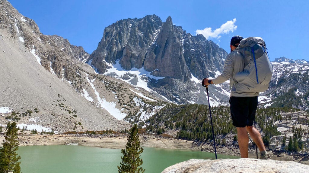
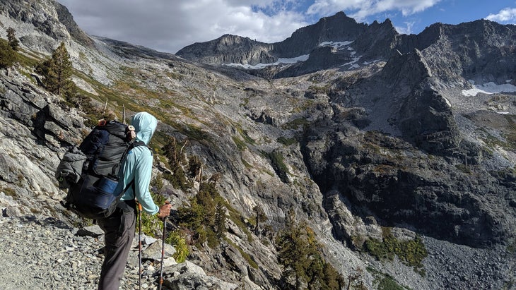
High Sierra Trail, California
???? Length: 72 Miles
???? Duration: 4 – 7 Days
⛰️ Elevation Profile: Moderate, with about 15,000 feet of total gain and loss
???? Best Starting Point: Crescent Meadow, Sequoia National Park
???? Why We Love It: Less in demand than, and a third the length of, its more famous neighbor, the John Muir Trail, this one condenses the majesty of one of the world’s most distinct mountain ranges.
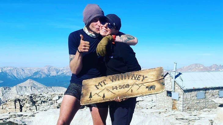
Ahh, the thru-hike, where the busyness of life and the bureaucracy of existence fall away into complete freedom. Wait, not so fast! Hiking long distances often involves applying for and sometimes being denied permits, plus the requisite fees and frustrations that come with the process, especially when a national park is involved. But that hurdle is worth it for the High Sierra Trail, an iconic if under-appreciated American route that, moving eastward, climbs from the valley holding some of the world’s biggest trees in Sequoia National Park past massive waterfalls and thick forests to the top of Mount Whitney, the highest point in the Lower 48. The logistics here can be challenging, including getting to and from the trailheads, but they’re worth figuring out.
In fact, consider the High Sierra Trail a no-frills sampler platter for what Kim Stanley Robinson famously called “the best mountain range on Earth, if backpacking is the game you want to play.” There are high-altitude catwalks with drops so steep the acrophobic might avoid them, dazzling tunnels daringly carved through rock walls, deep and steep glacial canyons, rivers that roar with the melt from mountains above, and peaks so intricately carved they suggest nothing less than divine intervention. If you want to experience one of the world’s most distinct regions and a legitimate national treasure, this is your getaway.
Don’t Miss: So often during a long haul, hikers yearn for warm water, a way to soak away their skeletomuscular soreness. Halfway into this trip, you’ll get exactly that at the Kern Hot Spring, a concrete catchment for the hot seeps nearby. It’s small, so don’t be greedy with time or too guarded about sharing with strangers. Into cold soaking, too? Jump in the Kern itself.
Lake Okeechobee Scenic Trail, Florida
???? Length: 110 Miles
???? Duration: 4 – 7 Days
⛰️ Elevation Profile: Easy, with very little elevation gain
???? Best Starting Point: Lake Okeechobee Park Trailhead
???? Why We Love It: So long as the sun in the Sunshine State doesn’t zap you, there may be no better place in the country to try going very fast for long distances.
When it comes to navigation, some trails are automatic; follow the white blazes to your next town stop, and so on. But others require choices about the particular version of a route you want to take, prompting a choose-your-own-adventure game. The Continental Divide Trail is famous for that, but the Florida Trail—most days, my favorite of the 11 National Scenic Trails—offers a miniature version of the same, with variations on its main line that make you choose whether to go through a town or around it, in this swampland or that one.
One such crucial wager comes near the southern end of the state, upon reaching Okeechobee, the enormous lake that appears as a big blue dot on a map. A 110-mile trail of asphalt and gravel with plenty of camping opportunities circumnavigates the lake, high atop the Herbert Hoover Dike. Florida Trail hikers choose one side or the other, depending on how soon they need food. But with its panoply of enormous waterfowl and slinking alligators, the whole thing seems entertaining, especially since the pancake-flat rim and rather easy logistics mean you can lean into your speed. Want to keep going? Stick to the Florida Trail, or turn due east for the great Ocean to Lake Trail.
Don’t Miss: One of the most glorious side effects of thru-hiking is that you can and should eat whatever you want to keep yourself going. When you reach Pahokee, a strangely charming town of 5,000 on Okeechobee’s eastern shore, walk a few hundred feet off the dike and go to Poppa Jimmy’s Catfish & More. Are the mounds of fried everything heaped on Styrofoam plates necessarily good for you? No. Do I think about them all the time? Yes.
Wonderland Trail, Washington
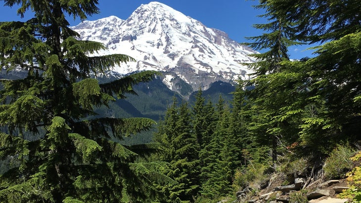
???? Length: 93 Miles
???? Duration: 5 – 14 Days
⛰️ Elevation Profile: Intense, with nearly 25,000 feet of gain
???? Best Starting Point: Longmire Wilderness Information Center
???? Why We Love It: Climbing Rainier, the highest point in the Cascades and the most glaciated peak in the Lower 48, can be an intense endeavor. Why not see this masterpiece from every angle around it instead?
On occasion, long-distance hikes will make you feel like Sisyphus or Zeno, trying to reach a point you can see but never quite reach. Especially on the Pacific Crest Trail, you pass around, beneath, or just beyond peaks of fathomless splendor and wonder if, by chance, the path will take you over them. Probably not. At least with the Wonderland Trail you know the score: You are here to hike around Rainier, one of the country’s most striking mountains. Not to its top. It’s almost always on the horizon, a snowcapped bulwark that reveals its intricacies—the glaciers that extend from its center like the arms of a starfish, its amphitheaters, crests, and cleavers—as you circumnavigate it.
But it’s not just the mountain that is staggering here. First built in 1915 and both shortened and moved to a higher elevation in the intervening decades, the Wonderland cuts through resplendent valleys and evergreen forests, across the 200-foot and nerve-quaking Tahoma Creek Suspension Bridge, and among immense wildflower meadows. Sunsets and sunrises with the mountain as the backdrop are often described as spiritual experiences, while the powerful waterfalls that line parts of the trail pull you back to center. Campsites are plentiful but permits are not, so start applying early or get ready for the walk-up scramble.
Don’t Miss: When lava flows from the surface, it cools and contracts, causing what is a single sheet to fracture and crack. When this happens vertically, “columnar jointing” produces towers of rock that look like rows of prisms or the pipes of an organ. The Wonderland Trail takes you right by a prime example, the Devil’s Pipe Organ, where moss and grass cling to a dramatic upward sweep of hundreds of curved columns locked in time.
Cumberland Gap’s Mischa Mokwa Adventure Trail, Virginia and Kentucky
???? Distance: 21 Miles
???? Duration: 1 – 2 Days
⛰️ Elevation Profile: Moderate, with less than 5,000 feet of gain
???? Best Starting Point: Pinnacle Overlook Parking Lot, Kentucky
???? Why We Love It: Thick forests and epic sightlines into three states make this trek through a historical location feel monumental.
One winter, when my wife, Tina, and I were still pretty new in our distance-hiking lives, we decided to drive from our Appalachian home to the famous Cumberland Gap, at the intersection of Virginia, Tennessee, and Kentucky. A longtime route for Indigenous people’s travel, the Gap became famous with U.S. settlers as a route into the west, immortalized not only by Daniel Boone’s escapades along the Wilderness Road but also by a handful of tuneful folk songs. Our plan was to hike the ridge in a day through a longer variation on the Mischa Mokwa Adventure Trail, overnighting near the turn-of-the-century Hensley Settlement about halfway through.
We did exactly that, but we learned a valuable lesson during that short trip: Make sure your layers are adequate for the places you’re headed, always. It had been unseasonably warm back at home, so we’d packed lightly for our January trip to the historic highlands. We shivered our way through the night and raced through ice-slick snow early the next morning. Thru-hiking is sometimes a game of making bad decisions and learning to see them through; start a long trail and you’ll soon realize this firsthand.
Don’t Miss: A wide arch in orange stone that seems somehow iridescent leads to a cavernous room full of fine, colorful sand. No, this isn’t Utah—it’s Kentucky. Dubbed Sand Cave, this wind-carved wonder is surrounded by waterfalls, a vast beach, and sweeping stands of rhododendron and fern, all reminders that you are indeed not in the Southwest.
Lone Star Hiking Trail, Texas
???? Length: 96 Miles
???? Duration: 3 – 8 Days
⛰️ Elevation Profile: Gentle, with less than 5,000 feet in total gain
???? Best Starting Point: Richards Trailhead, Texas
???? Why We Love It: Wouldn’t it be nice to tell people you hiked the longest trail in Texas? They don’t really need to know how long it is.
Let’s be honest: Sometimes, thru-hiking is about disappointment, about wanting to accomplish something that your body or conditions, from bad weather to fire closures, won’t allow. And so it goes at the moment for the Lone Star Hiking Trail, the longest sanctioned trail in Texas, which is now not sanctioned at all. Due to flooding in east Texas, many trails, including Lone Star, that cut through the Sam Houston National Forest just north of Houston are pending repair and improvement. In a place that prides itself on largesse, yet has one of the lowest percentages of public land of any state, the closures are bad news for hikers.
But it likely won’t stay that way forever, and the LSHT is a gem for anyone looking to log miles in the second-most populous state. Following white aluminum placards tacked to trees, the LSHT weaves through arid pine forests and magnolia glades, around grazing pastures and several surprising lakes. Its location in a national forest means there is infrastructure for a few food-and-shower stops along the way, and several major highways buzz in the distance. By most measures, the LSHT is not some scenic wonder, but it remains a win for public passage in a state that loves to stand its ground.
Don’t Miss: If you’re looking for a diversion and even a delicious meal, you’ll pass the Double Lake Recreation Area, stocked with all kinds of freshwater fish and bordered by a campground. Bring your packable rod and reel.
Grayson Haver Currin has hiked more than 10,000 miles on the United States’ National Scenic Trails and a whole lot more in the country’s national parks, national forests, and public lands. He finished the Triple Crown of Hiking with his wife, Tina, in 2023. He now lives high above Boulder, Colorado, at the edge of the Indian Peaks Wilderness, where he’s climbing mountains, planning the next long hike, and writing full-time about music, as he has since 2005. Follow his adventures on Instagram.