No products in the cart.
Outdoor Adventure
The Most Underappreciated Park for Adventure is Capitol Reef
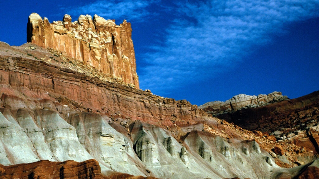
There’s a solid chance you’ve never heard of Capitol Reef National Park. Or maybe you’ve heard of the park, but as a destination it hasn’t cracked your top-ten bucket list, so you’ve never made the long trek to Southern Utah to experience its goods. I was in that same boat myself until last month.
I’ve criss-crossed Utah countless times in the last 30 years, hitting every other national park in the state, but I only recently had the joy of gazing out at my surroundings in Capitol Reef. Two days knocking out short day hikes throughout the park left me craving more.
The problem, which is also a blessing, is location. Surrounded by more famous destinations, Capitol Reef is often overlooked. Sure, people trek from all over the world to Utah on national-park road trips, but the vast majority are visiting Arches and Zion. Maybe Canyonlands or Bryce if they can squeeze in an extra day. Yet Capitol Reef is beautiful, and it might be the most adventurous unit in the entire national-park system.
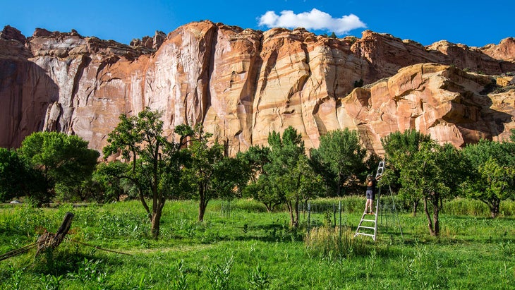
If you’ve heard of Capitol Reef at all, it’s probably because of its orchards, which are pretty damn cool. Starting in the late 1800s, settlers from the Church of Latter-Day Saints planted thousands of apple, cherry, peach, and pear trees in the Fremont River Valley, which is now within the boundaries of the national park. Many of those historic orchards are still thriving within the park’s boundaries, and the National Park Service is working on an orchard-replanting project to keep the fruit blooming for years to come. You can even pick fruit from orchards with U-Pick signs and self-pay stations.
But listen, there’s a lot more to Capitol Reef.
If you buy through our links, we may earn an affiliate commission. This supports our mission to get more people active and outside. Learn more.
Adventure Intel
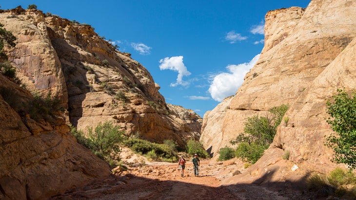
The park covers 241,904 acres of prime slickrock desert, encompassing the Waterpocket Fold, a nearly 100-mile-long uplift that has eroded into a cornucopia of cliffs, arches, natural bridges, and monoliths. The landscape is so remote and so rugged that the Waterpocket Fold area was the last land to be mapped in the continental U.S. Today that landscape still feels remote and adventurous.
“This was the spot that made me fall in love with Utah,” says Mike Hinkle, owner of Capitol Reef Adventure Company, who moved to the area to work as a guide more than two decades ago. “People say it’s in the middle of nowhere, but the landscape is unique, and it doesn’t feel like Disneyland. You’re not waiting in line to get on the shuttle. You’re not sharing a trail with 1,000 other people. You’re out there.”
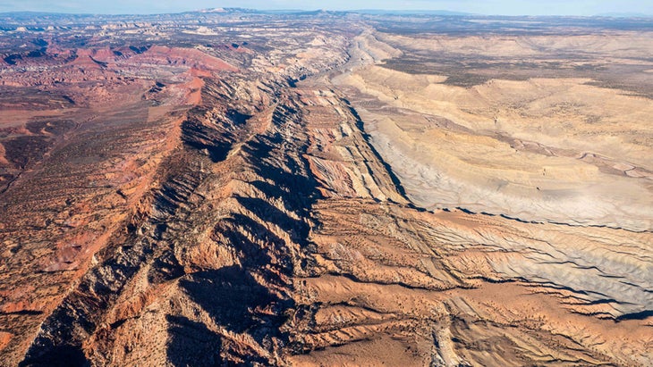
Capitol Reef is 60 miles long and six miles wide, bigger than Zion and Arches combined but with a fraction of the visitors. The park is divided into three distinct sections.
- Most visitors stick to the central portion of the park, the Fruita Historic District, where Highway 24 offers easy access to the Visitor Center, day hikes, and a front-country campground.
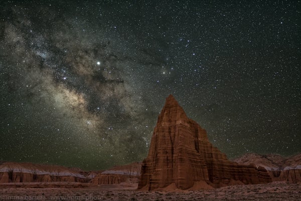
- Cathedral Valley occupies the northern section of the park, where mostly unmaintained dirt roads lead to domes and backcountry campsites.
- The southern part of the park, the Waterpocket District, is just as remote, full of dirt roads and narrow canyons and long hikes where you have to huff across miles of desert for grand views.
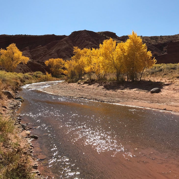
It is a park that delivers both for those who want a scenic drive/short hikes and backcountry-seekers, with a diversity of adventure that ranges from backcountry bike rides to roadside trad climbs.
“It’s a mix of the same rock you see in Zion and Arches,” Hinkle says. “Capitol Reef has its arches and cliffs and waterways that make it the same kind of rock features, but because it sees less people, we can actually guide technical adventures here.”
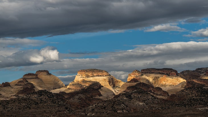
Here are the best ways to explore Capitol Reef National Park.
Check flights to Grand Junction, Colorado
Check flights to Salt Lake City
Day Hikes in Capitol Reef National Park
You can access the majority of front-country day hikes along Highway 24, which runs through the middle of the park and the Fruita Historic District. Here are three gems you can hit without driving on dirt to reach the trailheads.
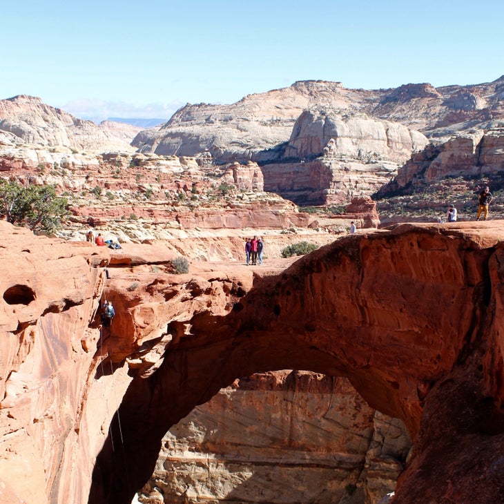
Cassidy Arch Trail
If the park has a signature trail, it’s Cassidy Arch, a 3.4-mile out-and-back to the celebrated stone arch, which forms a 125-foot-long bridge on the edge of a cliff high at the top of the Grand Wash Canyon. It’s classic desert scenery, skirting the edge of red sandstone cliffs and crossing acres of slickrock.
Grand Wash Trail
Starting from the same trailhead as Cassidy Arch, the Grand Wash gives day hikers a taste of the slot-canyon landscape without the common inherent dangers of mandatory rappels and flash-flood potential. The three-mile out-and-back meanders through a canyon with 200-foot walls that gradually narrow as you hike towards the center of the gorge. The hiking is flat and sandy, and after a mile, you’ll reach the skinniest point of the canyon, roughly 20 feet wide, a slot canyon but not constricted. This trail is an easy yo-yo hike that’s great for families with small children.
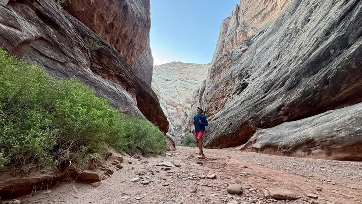
Hickman Natural Bridge
This 2.1-mile out-and-back passes through stands of junipers and cottonwoods as well as clusters of sand dunes, and lets you see the remnants of a granary built by the Fremont people, an indigenous culture that predates the Navajo and Ute. The crescendo is the sandstone Hickman Bridge, 125 feet tall and 133 feet across.
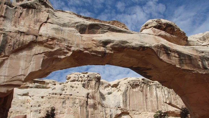
This is a moderate hike, gaining just under 500 feet in elevation, but if you want more, add on the Navajo Knobs Trail, which branches off from Hickman Natural Bridge Trail near the trailhead on Highway 24. It’s a 1,100-foot climb over 1.3 miles to the Rim Overlook, where you can stand on the edge of a cliff and peer 1,000 feet into the valley below.
Bike Rides in Capitol Reef National Park
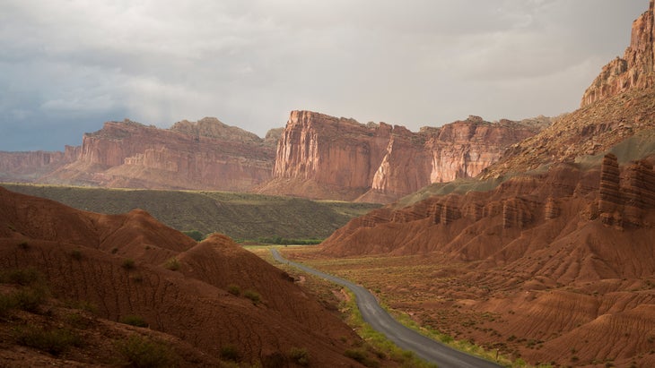
Capitol Reef is a biker’s dream. Highway 24 and the eight-mile Scenic Drive passing through dramatic rock formations offer mellow options for road cyclists and e-bikers, but if you really want to see the park on two wheels, hit the system of unpaved roads that traverse the backcountry, offering stellar views and solitude.
For truly hardy bikepackers, the burly 70-mile loop through the Cathedral Valley delivers you into some of the most remote corners of the park. It’s full of steep climbs and sandy or muddy wash crossings that can be tough to navigate with skinny tires, so I’d opt for a fat-tire mountain bike for this one. Also, there’s no water along the route, so you’ll need to carry enough for two to three days. But if you’re prepared, you’ll have this broad valley, which is loaded with towering sandstone outcroppings that reminded the original explorers of massive churches, to yourself. There are also six primitive campsites at the Cathedral Valley Campground (first come/first serve, free) roughly halfway through the loop, letting you break up the 70 miles into two days.
Capitol Reef National Park mountain biking trails (Courtesy Trailforks)
Canyoneering in Capitol Reef National Park
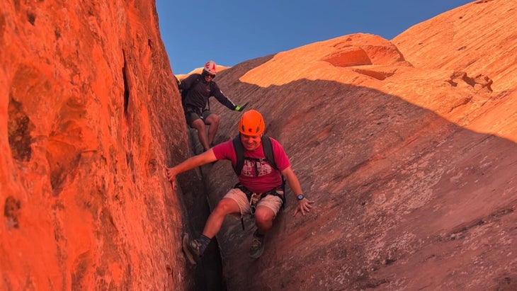
Guided canyoneering trips are prohibited inside Arches and Zion National Parks, but not here. Professional outfitters with commercial permits are allowed to guide rock climbing and canyoneering trips within Capitol Reef National Park. Unless you have the proper equipment and experience (flash floods are a concern in tight canyons that can drain water from even small storms), go with a guide.
Cassidy Arch Canyon
This is the most dramatic canyon within the park. It’s also one of the more technical, with eight rappels (more rappelling than hiking) on the journey through the sandstone subway. The adventure starts with a 150-foot drop through Cassidy Arch itself. It’s an airy descent as you lower from the sunny edge of the arch into the shadows of the canyon below. The rappels get shorter as you descend through the canyon, but you’ll drop through the center of two other natural bridges along the way. Capitol Reef Adventure Company offers full-day trips through Cassidy ($300 for the first person, $125 per additional person).
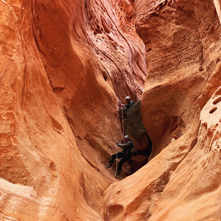
For those looking for a self-guided canyoneering adventure with easy access, venture into Lower Spring Canyon, a 9.5-mile point-to-point starting at the Chimney Rock Trailhead on Highway 24 and running to where Highway 24 crosses the Fremont River. It’s not an official trail and the route is unmarked, but you’ll find cairns along the way. Nor is it a technical descent, as the dry falls that need to be negotiated have bypass trails, removing the need for ropes. It is an adventurous hike, though, with scrambling, some narrow slot sections, and a mandatory crossing of the Fremont River towards the end of the journey. Carry plenty of water and only attempt this trek if that description sounds like something you can handle.
Sheets Gulch
Sheets Gulch offers a more remote nine-mile trek through narrow, textured Navajo sandstone walls before opening up to banks of Douglas firs. It’s an out-and-back, so make sure you turn around with plenty of daylight left.
In case you want to spend a couple of days exploring Capitol Reef’s signature narrow passages, two other popular slot canyons, Burro Wash and Cottonwood Wash, are located in the same area.
Rock Climbs in Capitol Reef National Park
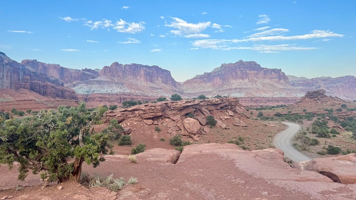
For decades, climbers mostly neglected Capitol Reef, but in the last few years the sandstone cliffs and boulders have received more attention, though they are still not as busy as Southern Utah hotspots like Bears Ears National Monument. You’ll find crack climbs on steep Wingate sandstone cliffs and collections of sandstone boulders both inside and outside of the park’s boundaries.
You need a day-use permit (free), which you can get at a self-serve kiosk at the Visitor Center, to climb or boulder within the park. Also, using white chalk is prohibited (use tan chalk instead), and first ascentionists can only use traditional removable protection in the rock rather than placing bolts for sport climbs. No climbing within 100 feet of rock art or prehistoric structures, nor on any arches or natural bridges.
Summers are hot, so consider Capitol Reef a fall-through-spring climbing destination. The approaches can be long, too, so bring water regardless of the season.
The Fruita Area, which is accessed by Highway 24 shortly after entering the park from the west, has the largest concentration of established climbs and boulders. Most of the established climbs are tough (5.10 or harder) but the unfortunately-named Pussy Bolt is a moderate trad 5.8 up a 50-foot wall via a wide crack that’s close to the road (bring hand-sized cams). Hundreds of established and potential boulder problems exist in the Grand Wash area of Fruita. Vithic Scatter (V2) is the classic, up a 15-foot sandstone rock via a sit start to pockets and jugs, with a walk-off topout.
Grab a copy of Capitol Gorgeous, a Climber’s Guide to Capitol Reef National Park and Beyond if you’re looking for other options.
Where to Stay in Capitol Reef National Park
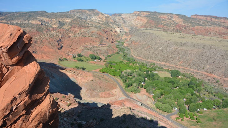
Capitol Reef has one of the coolest campgrounds in the park system: the 71-site Fruita Campground near the Fremont River Valley sits in an actual desert oasis surrounded by fruit trees planted by the Mormon pioneers of the 1880s. The facility can handle everything from tents to RVs, though there are no sewage, water, or electrical hookups (from at $25 a night, and make your reservations up to six months in advance).
I found dispersed camping outside the western border of the park on Fishlake National Forest just off Highway 24 near the town of Torrey. The camping is free, but there are no facilities.
Head down Highway 12 towards Boulder, Utah, and you’ll find developed campgrounds in Dixie National Forest at Singletree Campground and Pleasant Creek Campground. Capitol Reef has an NPS map with locations of alternative camping options surrounding the park.
The gateway town of Torrey has plenty of hotel solutions as well. Capitol Reef Resort is the closest to the park’s western entrance, with accommodations that range from Conestoga wagons to hotel suites (from $119).
Check Availability for Capitol Reef Resort
Where to Eat in Capitol Reef National Park
Torrey (pop. 257), which sits just outside the park’s western border, may be small, but it has plenty of restaurants to keep you satisfied. The Wild Rabbit Cafe has great coffee and breakfast (I like the burrito) that uses local eggs. Hunt and Gather is more of a fine dining option, using as many local ingredients as possible. Head to the next town over (Bicknell) for Curry Pizza, which melds Indian cuisine with pizza.
I left the area marveling at its wonders, while I wondered why the hell it took me so long to come here.
Graham Averill is Outside magazine’s national-parks columnist. Visiting Capitol Reef for the first time, and falling in love with it, makes him wonder what other hidden gems he’s been missing within the park system.
Want more of Outside’s travel stories? Sign up for the Destinations newsletter.
For more by this author, see:
Source link

