
No products in the cart.
Outdoor Adventure
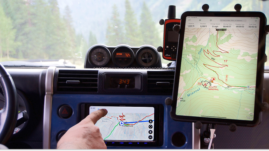
Beginner Gaia GPS Navigation for Trail Runners
10
Jan
Jan
This is the first in a two-part series on Gaia GPS navigation for trail runners. Find part two, “Advanced Navigation,” here.
In the pitch black surrounded by desert cliffs and vermillion soil, ultrarunner Courtney Dauwalter peered down at the Gaia GPS map illuminated on her phone screen. She was racing the 2017 Moab 240, a 240-mile continuous loop that starts and ends in the scenic Utah town. The circuit travels through steep, unforgiving terrain alongside Canyonlands National Park and south to the Abajo Mountains, then back up to the La Sal Mountains and Arches National Park. Dauwalter was in the lead —but had an inkling she was lost.
Fortunately, race director Candice Burt had asked race participants to use the Gaia GPS app to download the race course and topographic maps onto their phones as a safety backup. Despite Dauwalter’s achievements at the world’s most demanding ultrarunning events, she had never used a navigational app, preferring a simple Timex watch and the sun to help direct her jaunts. Her perspective shifted when she tried Gaia GPS.
“Gaia GPS is amazing. My husband helped me download the Moab 240 course and learn how to use the app’s basic functions. I was blown away,” said Dauwalter.
Here’s what Dauwalter and her trail running peers appreciate about the Gaia GPS app for navigation-tool rookies.
Offline Access
Conserving battery life is essential, especially when your phone doubles as a navigation device on an isolated, technical trail outing.
“While I used Gaia GPS, my phone could be in airplane mode, which is important for multi-day adventures like the Moab 240,” said Dauwalter. “I could see exactly where I was on the course route and map we had downloaded.”
With a fee-based premium membership, trail runners can download any map in Gaia GPS’s extensive catalog for offline use. That map becomes accessible in remote locations where connectivity isn’t possible due to lack of cell service or WiFi. Downloaded maps are also functional when the phone is in airplane mode, which saves battery output.
RELATED: Map and Compass Skills are Essential for Trail Running
Record Tracks
Before starting a run, athletes can press the record button to log a live track, also known as a “breadcrumb” trail. An icon marks their exact location with an arrow pointing in the direction the device is oriented. Trail runners can see their distance, elevation gain, and which cardinal direction they face. The tool makes Gaia GPS a great complement to GPS watches, because it offers a trail you can follow back to your starting point or previous trail should you get lost.
“Several times I got off course during the Moab 240. I could pull out the app, know where I was along my recording track, and see how to backtrack and course correct. The app was hugely valuable during the race,” said Dauwalter. “That experience opened my eyes to the possibilities of using the app for long adventures in the mountains near my house and for other races, even if it’s not required.”
Gaia Topo Map
A free membership provides access to Gaia Topo, Gaia GPS’s flagship map designed in-house. Its ingenious design and beautiful styling makes this map crystal clear at high zoom levels. With a premium membership, you can download your entire state or region quickly and easily thanks to Gaia Topo’s industry-leading file efficiency.
“The Gaia Topo map is wonderful, really well-labeled and friendly to use,” says professional runner Kyle Richardson. “Ninety percent of the time, I look at that standard base. I haven’t seen anything else with such accurate info.”
Trail Research
You can use Gaia GPS maps to see what paths and roads exist anywhere in the world. Trail runners can closely examine the environment and terrain, including steepness and waterways.
“I now use Gaia GPS to explore new areas, see which trails link up to make loops or lollipops, and study where trails eventually lead,” said Dauwalter. Gaia GPS displays the mileage and elevation gain, which can help runners plan adequate nutrition, hydration, and estimate the trip duration.
Upload Recorded Tracks
“When I trail run in an area that I don’t know well, I upload a track into Gaia GPS that I downloaded from somewhere like Strava to have a point of reference when I’m out there,” says professional trail runner Logan Greydanus. “I also use tracks at junctions in the dark to orient myself.”
When referencing a recorded track, remember to check the direction of travel from the trailhead or start point. If the route is a loop or lollipop, versus an out-and-back, determine if you’ll go counterclockwise or clockwise based on factors like start time, elevation gain, river crossings or water refills.
RELATED: Lost in the Wilderness? Don’t Change Your Voicemail.
Route Creation
“If I’m doing a big mountain adventure near home in Colorado, I’ll create a route and download the maps even if I’m familiar with the area, so that I have a route on my phone and I know what I’m getting into,” said Dauwalter.
Users can create routes ahead of time online or in the Gaia GPS app. For efficiency and ease, both the website and app have a snap-to-trail feature. The route does not appear as a straight line between each waypoint, which is placed with a mouse click. Instead, the line automatically snaps into place along the intended pathway, precisely following each turn and bend.
Premium members have access to the snap-to-trail feature while creating routes on-the-fly with a downloaded map. This allows you to modify your plans on the trail as needed.
Safety Backup
Emergencies happen when we least expect them, whether a lightning storm pops up or we come across another trekker in need. Gaia GPS can serve as a backup for getting yourself or others to safety if needed.
“Having the route created and online is also a safety backup for someone at home to know my exact itinerary,” said Dauwalter.
Gaia GPS is free with your Outside+ subscription. Find out more here!
Source link