
No products in the cart.
Outdoor Adventure
Gaia Can Help Find Trails for Hiking, Biking, and Off-Roading
29
Oct
Oct
For exclusive access to all of our fitness, gear, adventure, and travel stories, plus discounts on trips, events, and gear, sign up for Outside+ today
and save 20 percent.
This article was first published by Blog.GaiaGPS.com.
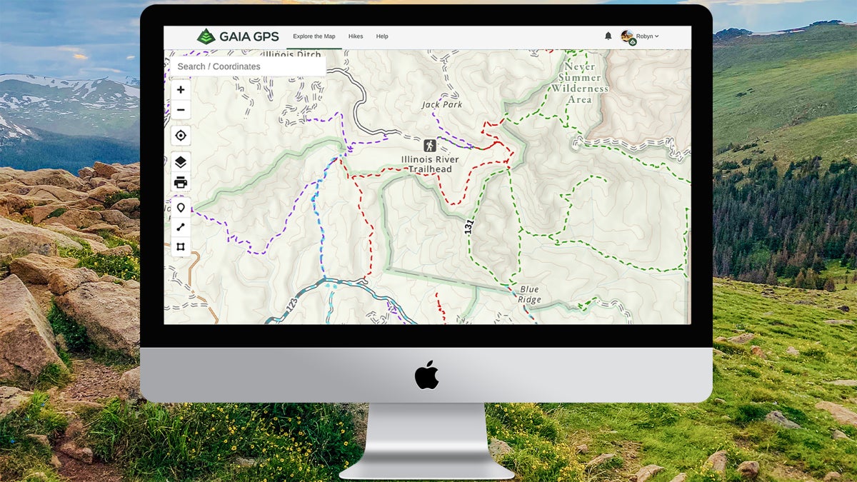
The United States Forest Service Roads and Trails layer on Gaia GPS displays color-coded trails for different activities so you can see if your favorite outdoor activities, like hiking, biking, motorcycling, and horseback riding, are allowed on your next trail destination. Each color on the map signifies which activity is allowed on the trail. Click on the trail and a pop-up displays even more information, including the name of the trail, all of the allowed uses for that trail, and trail specifications and characteristics.
Whether you are wondering where to ride your mountain bike, or looking to avoid areas that allow bikes and motor vehicles, this layer makes it easy to find the right trail for your next adventure.
The U.S. Forest Service Roads and Trails Layer
The USFS Roads and Trails layer shows maintained routes, 4×4 trails, backroads, and little-known paths across U.S. national forests and grasslands. This map contains many routes unavailable in any other map in Gaia GPS, including water routes, winter-only routes, and canoe trails. Road labels indicate the level of maintenance and accessibility by passenger vehicles.
The new color-coded trails in this updated layer display the permitted uses on the trails. Trails colored with a dashed black line indicate trails open to hiking. Green indicates a trail open to horseback riding, red open to mountain biking, and purple open to motorcycles and ATV use. A blue dotted line signifies a water route and light blue shows a winter-use trail. Gray double-dashed lines display 4×4 routes and dirt roads.
Tap the trail and a pop-up displays the trail name, the trail number, all the allowed uses for that specific trail, the grade of the trail, and the trail’s surface material and tread width.
The USFS Roads and Trails layer is designed to lay on top of your favorite base map. Pair it with Gaia Topo, USGS Topo, or Open Cycle Maps HD, just to name a few, to find the best trails for your next adventure.
How to Add the USFS Roads and Trails Layer
Access the USFS Roads and Trails layer with a Premium Membership. Add the layer by clicking the layers icon, select Add Map Layer, tap Feature/Weather Overlays, scroll down and add the USFS Roads and Trails layer. Layer it on top of Gaia Topo or use it with your favorite base map. For tips on adding the USFS Roads and Trails and any other layer on Gaia GPS, visit this help center article.
Source link