
No products in the cart.
Outdoor Adventure
Navigate Public and Private Lands with Gaia GPS

07
Nov
Nov
For exclusive access to all of our fitness, gear, adventure, and travel stories, plus discounts on trips, events, and gear, sign up for Outside+ today
and save 20 percent.
This article was first published by Blog.GaiaGPS.com.
Find hidden game reserves, connect the dots on your big hiking loop, and camp in solitude using the Public Land and Private Land maps (both U.S. maps only) from Gaia GPS. This duo can be used in tandem to quickly and easily decipher public and private land rights.
You’ll always know where you can and can’t go with this tool kit in your pocket, which will help you avoid trespassing and determine landownership, so you can ask for permission to pass through private areas, as well as find peaceful, obscure camp spots far from the crowds. With these maps, you can also view who manages public lands in order to find more information about camping regulations, vehicle accessibility, and hunting laws. Plus, the Public Land map just got even better: Gaia has added 1.5 million acres to it, for an even more comprehensive look at federally managed land across the country.
Whether you’re route-planning on your desktop at home or navigating offline in the field, the Public and Private Land maps can assist on any adventure. Each provides coverage across the entire U.S. Read on to learn how to use these maps on your next trip.
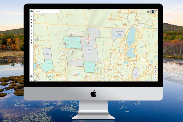
Public Land Map
Discover state forests to explore in your backyard or Bureau of Land Management terrain to camp on during your next road trip. America’s public lands provide some of the best resources for hiking, off-roading, bikepacking, fishing, kayaking, canoeing—you name it. The Public Land map features the most current and comprehensive data of these government-managed areas.
Hikers, hunters, overlanders, and anyone exploring areas of mixed-land ownership may want to consider using this layer, which emphasizes:
- National and state forests
- Parks and monuments
- Wildlife refuges
- Conservation lands and game preserves
- BLM areas
Color-coded federal lands easily identify which government agency manages an area. And with more than 1.5 million acres of public land at your fingertips, you’ll have the most accurate and comprehensive coverage available. The expanded coverage encompasses everything from nearly 327,904 more acres of land managed by the National Parks Service (an area the size of Grand Teton National Park) to 106,447 more acres of U.S. Forest Service (USFS) land (the size of Antigua and Barbuda combined).
The updated layer draws on the most exhaustive and precise data sets available, so you can find secret caches of public land; it displays privately held inholdings in federal and state parks that may not appear elsewhere, as well as smaller public lands missing from many popular maps. Bear in mind that not all of the areas in the layer will be open to the public, and that there are restricted zones located within otherwise accessible lands.
Private Land Map
Use the Public Land layer in conjunction with its complement, the Private Land map, to enjoy access to landownership data for every single state. Various outdoor enthusiasts and professionals (anyone from hunters to conservation officers to first responders) can easily access critical information using this Private Land map. If you’re planning a hunt in a new zone, use the Private Land map to quickly scout the area and surrounding property lines. Bird hunters pursuing everything from pheasants in South Dakota to mallards on the U.S. flyways will also find the quick access to landownership data useful.
The Private Land map shows landownership information and parcel sizes. Just tap on a land parcel to get more ownership information, including the address (if publicly available). Property lines are marked by bright yellow boundaries that you can’t miss.
Downloading offline maps with the U.S. Private Land overlay will benefit game wardens working with landowners in remote areas. Search and rescue personnel can use Gaia GPS as a single source for coordinating search efforts in areas with multiple landowners. Utilizing both the Private Land map and the area feature, firefighters can use Gaia GPS to complete wildfire-incident reports.
How to Use the Public and Private Land Maps
Pair both maps on top of your favorite base map, such as Gaia Topo or the Satellite Imagery layer, to get a quick and clear sense of land designation. This technique proves especially useful for hunters who want a crisp aerial view with property lines. Combining the Private Land and Public Land maps along with state-specific game-management-unit overlays will let you focus on the hunt instead of worrying about where the big bull or buck you’re stalking is headed.
While you can see public-land information right in Gaia Topo, area shading in the Public Land map offers an even clearer picture. Add the Private Lands map to make sure you avoid trespassing or to obtain permission to pass through a private property. Get detailed directions for layering maps together here.
Get the Public and Private Land Maps
Public Land (U.S.) and Private Land (U.S.) maps are available with a Gaia GPS premium membership. Premium comes with the ability to layer maps atop each other, so you can see both public and private land markers as well as topographic detail, landmarks and waypoints, and satellite imagery.
Going premium also lets you download maps for offline use, so you can always find your way and see whose land you’re on while in the field. A premium membership gives you access to the entire map catalog of Gaia GPS. Download hundreds of maps, including National Geographic Trails Illustrated, high-resolution satellite maps, weather overlays, and government-issued topo maps like USFS topo, all the USGS quad maps, and motor vehicle use maps.
Source link