
No products in the cart.
Outdoor Adventure
Use This App to Find the Best Fall Foliage
24
Sep
Sep
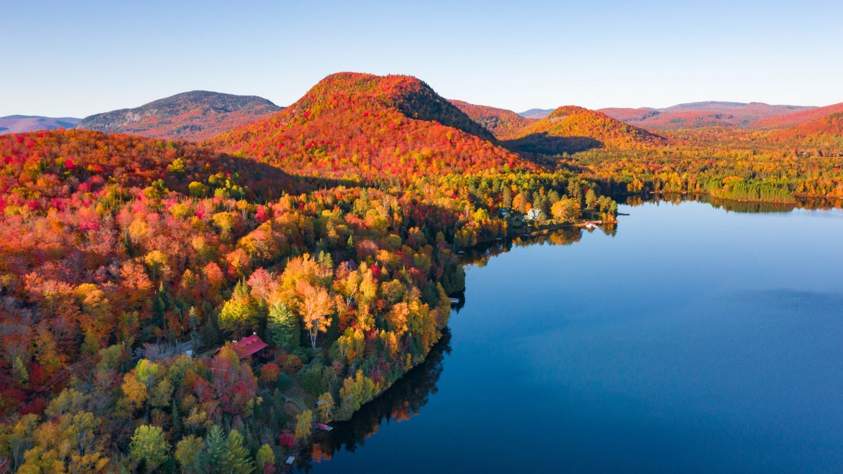
You reach the trailhead after a long drive and begin marching into the woods in search of those brilliant fall colors that arrive each year with the first chill. Then, a depressing reality greets you: the trees are already skeletal, their leaves crumpled on the ground. Yep, you mistimed your fall foliage adventure.
There’s a new method to find peak fall colors, and it could help you decide whether or not to trek to your favorite grove of trees. Our Outside Inc. colleagues at Gaia GPS now have access to satellite images from the United States Geological Survey and the European Space Agency, and the pictures capture the reds, oranges, and yellows of fall foliage. Here’s how these recent satellite images can help you plan your next leaf-peeping adventure.
Where to start: the Fall Foliage Prediction Map
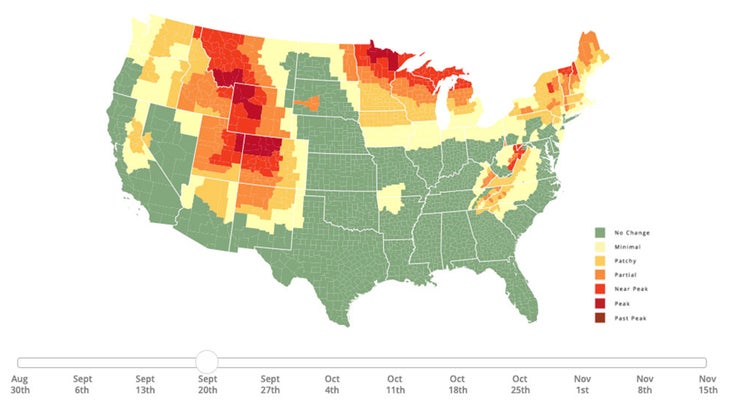
Start your planning with the fall colors prediction tool on SmokyMountains.com. Created by David Angotti and Wes Melton, this map uses meteorological data to forecast when the colors will build, peak, and then drop. The page will give you a general idea of when the leaves in your area will be turning. You can use the scroll bar at the bottom of the map to see when colors are slated to peak in the region you plan to visit.
Next: Find your location on Gaia GPS
To plan your route, either visit Gaia GPS online or open the smartphone app. You will need a premium membership to access the satellite imagery. Gaia’s default is the worldwide topographic map, and you can scroll across the screen to find the region you plan to visit.
Once you’ve honed in on your destination, click on the Layers tab on the left side of the screen. You can search through a variety of imaging layers offered by Gaia GPS in the Layers tab. Add the “Fresh Sat – Recent” and “Fresh Sat- Cloudfree” options to your active layers. Both layers are composed of images taken from as recently as today or over the past two weeks by the two satellites.
Look for colors
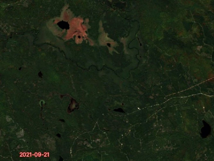
The images provided by the two satellites have a lower resolution than those from Gaia’s normal satellite imagery—approximately 10 to 15 meters per pixel. So you won’t be able to zoom in to see minute details like road surface or individual clumps of trees. But the images will clearly show swaths of yellow, orange, and brown on the screen. For even higher quality sat imagery, check out the app’s World Imagery layer.
Make sure to look at the date stamp on the image—it will be in red block text in the bottom left-hand corner of the tile. This is when the image was snapped. Some images are as recent as the same day, others may be a few days older.
If the area is obscured by cloud cover, search the Fresh Sat – Cloudfree layer. While this layer may not be as up to date as the Fresh Sat – Recent layer, it will have cloudless images of the area.
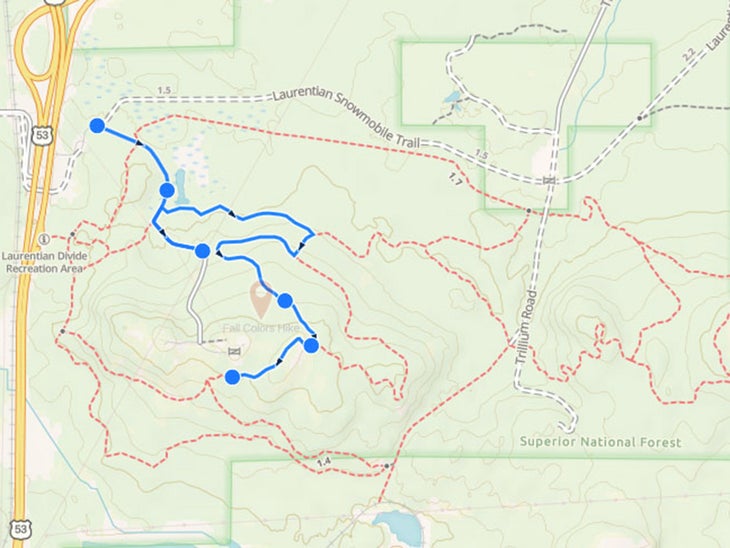
Drop a waypoint and plot a route
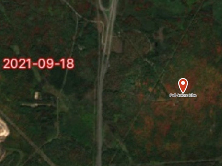
Locate the best colors on the map. Then, click on the “waypoint” icon in the right-hand toolbar, and drag the red icon to the specific point on the map. Drop the icon and then customize your waypoint with a name and an emoji symbol. Don’t forget to save your waypoints.
Then, back in the layers tab, click on the Fresh Sat – Recent scroll bar and move it all the way to the left. This action will make Gaia’s worldwide topo map appear. You can now use the route tool in the right toolbar to plot a hiking, biking, or driving route to your waypoint. No matter your transportation choice, the route tool will automatically snap to the optimum roadway or network of trails.
Download your route
If you’re heading to an area with poor or no cell service, be sure to download your map in the Gaia GPS app before you depart. That way, you can navigate to and from your waypoint, even if you are off the grid. Downloading a map requires a Gaia GPS premium membership.
Allow for some flexibility
Because some of the satellite images may be a few days old, take note of the timestamp on each image and use your own judgement on the progression of the leaf colors. If the trees in your area go from green to orange to red, and the image is a few days old, then prioritize orange areas over the red ones. If the leaves are already brown, save yourself the drive—and start plotting next year’s leaf adventure.
Gaia GPS is a part of Outside Inc., the same company that owns Outside. For a Gaia GPS premium membership, sign up here.
Source link